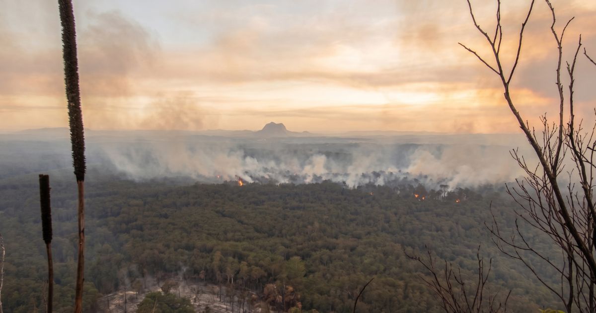
On the first weekend of August 2026, wildfires around Spokane, Washington forced roughly 60,000 people from their homes and damaged or destroyed at least 600 structures. The smoke did not stay with the fires. It rolled across the Northwest, greyed out summer skies over Seattle and Portland, and left haze as far away as the Great Lakes.
If you had a hike planned anywhere under that sky, on the Pacific Crest Trail, the John Muir Trail, or the local hill, you faced the season’s question: is it safe to go? Most of us answer it with one glance at an air quality number on a phone, without knowing what that number measures or what it leaves out.
So we asked the people who make the forecast. AccuWeather’s meteorologists answered sixteen of our questions in writing, and this article is what we learned. The complete, unedited interview is at the bottom, so you can check every quote in its full context.
As this article goes out, the air over most of the West is the cleanest it has been in weeks. That is not the season ending, it is the wind changing. The maps below show what nine days did to the smoke, and what they did not do to the fire risk underneath it.
The short version:
- Above AQI 100, cut your time outside. That is AccuWeather’s threshold.
- The number describes a region, not your trail. In the mountains it may even be partly an estimate.
- Smoke forecasts are solid about two days out. Make the final call the day before, or the morning of.
- Valleys hold the thickest smoke overnight and at daybreak. Climbing above it sometimes works, never reliably.
- Unusually short of breath, dizzy, or wiped out? Stop and get to cleaner air, whatever the number says.

Who Answered Our Questions
How this article was made. The interview was conducted in writing in August 2026, arranged through AccuWeather’s media relations team. The answers were written jointly by Adam Douty, Senior Meteorologist, and Peyton Simmers, Meteorologist, both of AccuWeather, so every quote is attributed to them together. No money changed hands in either direction. The agreed scope: air quality and what it means for hikers, not trail-by-trail forecasting. Their full answers are published unedited below the article. More on how we handle arranged interviews in our editorial standards and how we test.
One thing to know up front: this piece is about smoke and weather, not medicine. Where a question crossed into health territory, the meteorologists pointed us to doctors instead of guessing, and we have done the same. Every health statement below is either their direct words or cited to the EPA.
The Rest of the Season, in One Answer
We asked what hikers and campers in the Northwest should expect from here. The answer was blunt: “The wildfire risk is set to remain in place for the time being as limited rainfall and ongoing drought will keep the risk elevated at least through August,” Douty and Simmers told us. “This means poor air quality from smoke can remain in pockets across the Northwest.”
And this is not only a Northwest story. They compare 2026 with 2023, the summer Canadian smoke turned New York orange and fires moved smoke “from coast to coast.” Fires ruining the air 1,000 miles1,600 km away is “not too common,” they say, but when several massive fires burn at once, smoke can travel “hundreds to thousands of miles.” July proved it again, with Canadian smoke reaching the Great Lakes and the Northeast.
Nine Days of Maps
AccuWeather sent us their forecast maps twice, nine days apart. Side by side they show the one thing about smoke season that is easiest to get wrong: the air can clear completely while nothing underneath it has changed.


Now compare those with the weekend map at the top of this article. The coast-to-coast haze is gone, and the thickest smoke is down to two small patches in British Columbia and eastern Washington. Look only at the smoke maps and you would conclude the season was winding down. The fire risk maps say otherwise.


The extreme band did not fade, it moved: from Idaho and western Montana to eastern Oregon and northern Nevada, while the moderate zone kept covering the West from the Pacific to the Plains and pushed further into British Columbia. That is exactly what Douty and Simmers described: limited rainfall and ongoing drought keeping the risk elevated at least through August, with poor air quality remaining in pockets. A clear weekend is a wind pattern, not a verdict on the season. It is also the best possible time to learn how to read one, because the next smoky week is only a wind shift away.
What the Number on Your Phone Really Tells You
The Air Quality Index is the number most hikers stake the decision on. Here is what it measures during a smoke event, in their words:
“During a wildfire smoke event, the Air Quality Index (AQI) is often driven by fine particles known as PM2.5. These tiny particles can travel deep into the lungs, and higher AQI values indicate greater potential health concerns. However, AQI does not tell someone exactly how much smoke they will encounter at a particular spot on a trail.”
Adam Douty and Peyton Simmers, AccuWeather
Three things to take from the full answer:
- The AQI mostly tracks tiny smoke particles (PM2.5) that reach deep into your lungs. Higher number, bigger concern.
- It is a regional number, and a hike is a local act. Smoke “can vary over short distances and change quickly with wind and terrain,” so the air on your trail can be thicker or thinner than the reading.
- In the mountains, the reading may be partly a guess. Monitors are sparse in exactly the terrain hikers care about. Far from a station, they told us, your phone “may rely partly on estimated conditions rather than a measurement at that exact location.”
None of that makes the number useless. It just means one number should not carry the whole decision on its own.
The Number to Remember: 100
We asked for actual thresholds, and they gave us one: “We recommend at AQI levels of 100 or greater that people take precautions by shortening their time outdoors for poor air quality. Even wearing a N95 mask is helpful, though it is up to the individual person to make their own decisions.”
AQI 100 is no arbitrary line. It is exactly where the EPA’s official scale flips from “Moderate” to “Unhealthy for Sensitive Groups.” Above it, start cutting your exposure.
What they would not give us is a call-it-off number for healthy adults. That fits everything else they said: the reading may not match your trail, and conditions change by the hour. So instead of a fake-precise cutoff, use their threshold to start shortening, and the symptom list further down as your hard stop.
Who should sit smoke days out
Their answer on who should not be making a judgment call at all: “People with underlying respiratory/health issues. People should talk to their doctors about this.”
The EPA draws that circle wider than most people expect. Its wildfire smoke guidance counts people with heart or lung disease, older adults, children and teens, and pregnant people as sensitive groups. In any of those groups, or not sure? That is a conversation for your doctor, not a number to negotiate with at a trailhead.
Working hard makes it worse
Hiking is not standing still. Climbing means moving far more air, often gulped through the mouth. We asked how much that raises your actual smoke dose, and the meteorologists would not guess: “We would recommend consulting a medical expert on how smoke and breathing works on the trail.”
Fair enough. The EPA’s guidance fills the gap: the harder you work, the more air, and the more smoke, you pull into your lungs, which is why it advises cutting both time outdoors and intensity during smoke events. In hiking terms: the same AQI costs you more on a climb than on a flat walk. On marginal days, flatter and shorter beats steeper and longer.
Can You Climb Above the Smoke?
Every smoke-season forum thread contains the same theory: get above it. Their verdict: sometimes.
“Climbing higher does not always get you above the smoke, but it can help sometimes. Smoke can become trapped in valleys, especially when the atmosphere is stable during the morning hours, so a higher ridge may sometimes have cleaner air. However, wind, terrain, atmospheric stability and the height and location of the smoke plume all determine whether conditions actually improve with elevation.”
Adam Douty and Peyton Simmers, AccuWeather
Four separate factors have to line up, and one of them, how high the smoke itself sits, is invisible from the trailhead. Treat “I’ll just climb out of it” as a hope, not a plan.
Camping in a valley? Expect the worst air at breakfast
Smoke has a daily rhythm, and it is bad news for tents in valleys: “Smoke often settles into valleys and drainages overnight as the ground cools,” they explain, which “can lead to greater smoke concentrations overnight and around daybreak.” Daytime heating usually stirs the air and thins the smoke out again.
Put plainly: a valley campsite is where smoke pools while you sleep, and the classic dawn start puts you on the move during the thickest air of the day. On smoky trips, that habit is worth rethinking.
Is there a best time of day? Not reliably
“There is no time of day that is reliably best during every smoke event,” they told us. Mornings are often worst in valleys and midday mixing often helps, but “shifting winds” overrule the pattern whenever they like. Tendency, not rule.
Where the Forecast Actually Comes From
Hikers get told endlessly to “check the forecast.” Almost nobody explains what is behind it, so we asked them to walk us through it. Boiled down, a smoke forecast stacks four systems on top of each other:
- Satellites spot the fires and the smoke already in the air.
- Drought maps show where the fuel is dangerously dry.
- Computer models flag where gusty winds and dry spells could start new fires, and project where the wind will carry the smoke.
- Global climate patterns, like El Niño, hint months ahead at which regions are loaded for a bad season.
The number on your phone is the last, most compressed step of that chain. The full answer, with everything they watch, is in the interview below.
The two-day rule
The most useful planning fact in the whole interview came from asking what is hardest to get right: “The hardest part about making a fire forecast is the trajectory models for smoke are not the best outside of 2 days. In that case, we use other models to look at upper level winds to determine where smoke can go.”
Translation: tomorrow’s smoke forecast stands on solid ground. The outlook for your hike five days out is an educated read of high-altitude winds, made by professionals but much softer. So use the long-range picture to stay flexible, and make the real go or no-go call the day before, or the morning of.
Even then, they are clear about the limit: a forecast “cannot tell a hiker exactly what the air will be like at a particular trail, ridge or campsite.”
The Smoke Decision Card
We condensed the interview into a card you can use at 6 a.m. with coffee in one hand. Every line traces to a source: [AW] comes straight from Douty and Simmers’ answers, [EPA] from the EPA’s published definitions. Nothing on it is our invention.
Wildfire Smoke: The Hiker’s Go / No-Go Card
| Situation | What to do |
|---|---|
| AQI 0 to 50 (Good)EPA | Air poses little or no risk. Still check the forecast for where the smoke is heading; conditions can change during the day.AW |
| AQI 51 to 100 (Moderate)EPA | Acceptable for most people. If you are unusually sensitive to air pollution, consider trimming long, hard efforts.EPA |
| AQI above 100AW | AccuWeather’s threshold: take precautions and shorten your time outdoors. A properly fitted N95 helps, but does not remove the risk, especially while working hard.AW |
| Underlying respiratory or other health issues, at any AQIAW | Talk to your doctor before hiking in smoke at all. The EPA’s sensitive groups also include people with heart disease, older adults, children and teens, and pregnant people.EPA |
| On the trail: unusual shortness of breath, chest discomfort, dizziness, headache, or unusual fatigueAW | Stop the activity and get to cleaner air. Coughing is not the only warning sign.AW |
| You cannot see or smell smokeAW | Not proof of clean air. Fine particles can remain when smoke is not noticeable. Trust the reading, not the view.AW |
| Before leaving the houseAW | Check the current and forecast air quality for the specific area you will hike, not for your home town.AW |
[AW] = from the written answers of AccuWeather meteorologists Adam Douty and Peyton Simmers, August 2026. [EPA] = EPA AQI definitions and wildfire smoke guidance. The card was assembled by OutdoorAdept and has not been reviewed by AccuWeather. It is general information, not medical advice. You are welcome to reproduce this card with credit and a link to this page.
The Morning of the Hike
Everything above, folded into the ten minutes before you leave:
- Check one thing above all. Asked what a hiker should check if they check exactly one thing, they said: “the current and forecast air quality for the specific area where they plan to hike.” The specific area. Not your city, not yesterday.
- Do not trust your eyes or nose. The misconception they most want corrected: “if you cannot see or smell much smoke, the air must be safe.” It is not; fine particles linger when smoke is barely noticeable.
- An N95 buys margin, not permission. “A properly fitted N95 can reduce exposure to the fine particles in wildfire smoke, but it does not eliminate the risk, especially during strenuous activity.” Whether the breathing resistance is worth it, they say, is personal preference.
- Know your stop signs. Beyond coughing: “unusual shortness of breath, chest discomfort, dizziness, headache or unusual fatigue are signs to stop the activity and get to cleaner air.” On a hot climb every one of those is easy to blame on the climb. During a smoke event, stop blaming the climb.
Hiking in the smoke zone right now? Tell us what it’s like
Forecast maps show the big picture. You are standing in the actual air. If you have been on trail during this smoke season, we want to hear it: how far you could see, whether the ridge was really clearer than the valley, what you wish you had known before setting out.
Send your trail report through our contact page. Real reports from hikers help us keep this guide honest, and we may quote yours, with credit, in future updates of this article.
What This Article Can’t Do
This is national-scale meteorology, not trail-level forecasting; AccuWeather was clear from the start that trail-by-trail is not something anyone can responsibly offer. Monitors are sparse in the mountains, conditions shift by the hour, and nothing here replaces checking the forecast on the day. The interview was conducted in writing in August 2026; the season’s specifics reflect that moment, while the way smoke behaves in terrain does not expire. On the medical side, the meteorologists and this article both say the same thing: for anything beyond general caution, ask your doctor.
Trail tips, news and giveaways
One email a month: hiking tips, gear news, giveaways, fresh footwear verdicts and more. No spam, unsubscribe anytime.
The Full Interview, Published in Full
Below is the complete set of questions we sent and the answers as we received them from AccuWeather meteorologists Adam Douty and Peyton Simmers in August 2026. Nothing has been cut or reordered; our only edits are four minor spelling corrections. Where our questions mention measurements, unit conversions are ours.
Q1.The fires near Spokane forced roughly 60,000 people to evacuate and damaged or destroyed at least 600 structures. Setting the immediate emergency aside, what should someone planning to hike or camp in the Northwest expect from the rest of this season?
“The wildfire risk is set to remain in place for the time being as limited rainfall and ongoing drought will keep the risk elevated at least through August. This means poor air quality from smoke can remain in pockets across the Northwest.”
Q2.How does 2026 compare with recent years for smoke, in terms of how long the season lasts and how far the smoke travels? Is there a trend you can point to in the data?
“The 2026 smoke does compare with the smoke that was observed in 2023 when a lot of the Northeast saw poor air quality from Canadian Wildfire smoke. There were additional wildfires that erupted out west in 2023 that transported smoke from coast to coast.”
Q3.In July, Canadian smoke reached the Great Lakes and the Northeast. How routine has it become for someone hiking 1,000 miles1,600 km from any fire to have to think about smoke at all?
“It is not too common that fires thousands of miles away affect AQI to poor levels but if there are several massive wildfires burning like there was in Canada in July, the smoke can reach hundreds to thousands of miles away and reduce air quality. It is important to check the AQI and weather forecast before setting out on a hike so people can prepare for the proper conditions.”
Q4.What is an AQI reading actually measuring during a wildfire smoke event, and what does it miss that would matter to someone out on a trail?
“During a wildfire smoke event, the Air Quality Index (AQI) is often driven by fine particles known as PM2.5. These tiny particles can travel deep into the lungs, and higher AQI values indicate greater potential health concerns. However, AQI does not tell someone exactly how much smoke they will encounter at a particular spot on a trail. Smoke conditions can vary over short distances and change quickly with wind and terrain, so the air a hiker experiences may be different from the broader AQI reading.”
Q5.Is there an AQI level at which you would tell a healthy adult to shorten a planned hike, and a level at which you would tell them to call it off entirely? If you are willing to name numbers, we would like to publish them as your guidance.
“We recommend at AQI levels of 100 or greater that people take precautions by shortening their time outdoors for poor air quality. Even wearing a N95 mask is helpful, though it is up to the individual person to make their own decisions.”
Q6.Hiking uphill means moving a great deal more air, often through the mouth rather than the nose. How much does hard exertion change someone’s actual smoke exposure compared with standing still at the trailhead in the same air?
“We would recommend consulting a medical expert on how smoke and breathing works on the trail.”
Q7.Who should treat a smoke event as a hard stop rather than a judgment call? We want to be precise about which groups should simply stay home.
“People with underlying respiratory/health issues. People should talk to their doctors about this.”
Q8.Hikers often assume they can climb above the smoke. Does that work, and what determines whether a ridge is genuinely clearer than the valley underneath it?
“Climbing higher does not always get you above the smoke, but it can help sometimes. Smoke can become trapped in valleys, especially when the atmosphere is stable during the morning hours, so a higher ridge may sometimes have cleaner air. However, wind, terrain, atmospheric stability and the height and location of the smoke plume all determine whether conditions actually improve with elevation.”
Q9.For anyone camping in a valley or drainage, how does smoke typically behave overnight and at first light compared with the middle of the day?
“Smoke often settles into valleys and drainages overnight as the ground cools and the atmosphere becomes more stable. This can lead to greater smoke concentrations overnight and around daybreak. As daytime heating increases, the atmosphere typically becomes better mixed, which can help disperse the smoke, although conditions depend on winds and nearby fires.”
Q10.Is there a time of day that is reliably better or worse for being outdoors during a smoke event, or does it vary too much to generalize?
“There is no time of day that is reliably best during every smoke event. Overnight and early morning can be worse in valleys where smoke becomes trapped, while daytime heating and stronger winds can improve dispersion. However, shifting winds may blow higher concentrations of smoke into or out of an area leading to exceptions that can regularly occur.”
Q11.Can you walk us through how AccuWeather produces a wildfire smoke forecast? What goes into it: satellite detection, fire perimeter data, transport models, surface observations?
“When we make a forecast for wildfires, there are a lot of variables that go into it. We use satellite to identify wildfires and smoke in the atmosphere, we look at where there is ongoing drought. Computer models can give us wildfire parameters and indicate where the potential for gusty winds and limited rainfall can lead to new fires starting. These models show us where smoke can be transported to, away from the fires. Even prior to fire season, we look at teleconnections globally, such as El Nino (ENSO), to determine where fires could be more favorable.”
Q12.Which part of that is hardest to get right, and how many days out does a smoke forecast stay genuinely reliable?
“The hardest part about making a fire forecast is the trajectory models for smoke are not the best outside of 2 days. In that case, we use other models to look at upper level winds to determine where smoke can go.”
Q13.What can a smoke forecast not tell a hiker? Where do people read more certainty into it than is actually there?
“It cannot tell a hiker exactly what the air will be like at a particular trail, ridge or campsite. Air quality from smoke may change rapidly depending on wind conditions, which can vary significantly within a short period of time.”
Q14.Air quality monitors are sparse in mountain terrain. If someone is 20 miles32 km from the nearest station, how much should they trust the reading their phone shows for their location?
“Smoke can vary significantly from one valley or ridge to another, especially if there is a fire nearby and smoke has not had a chance to disperse significantly, so a phone reading for an area without a nearby monitor may rely partly on estimated conditions rather than a measurement at that exact location.”
Q15.Do N95 masks make sense while actually hiking, or does the exertion and breathing resistance cancel out the benefit? And what are the signs that someone should turn around, beyond the obvious coughing?
“A properly fitted N95 can reduce exposure to the fine particles in wildfire smoke, but it does not eliminate the risk, especially during strenuous activity. This seems like more of a personal preference than anything (whether or not the breathing resistance outweighs the benefit). Beyond coughing, symptoms such as unusual shortness of breath, chest discomfort, dizziness, headache or unusual fatigue are signs to stop the activity and get to cleaner air.”
Q16.What is the most common or most dangerous misconception about wildfire smoke that you would like corrected? If a hiker checks exactly one thing before leaving the house, what should it be?
“One dangerous misconception is that if you cannot see or smell much smoke, the air must be safe. Fine smoke particles can remain in the air even when smoke is not especially noticeable. If hikers check one thing before leaving, it should be the current and forecast air quality for the specific area where they plan to hike.”
Our thanks to Adam Douty and Peyton Simmers for taking these on, and to the AccuWeather media relations team for arranging the interview. You can find their forecasts, including air quality, at accuweather.com.