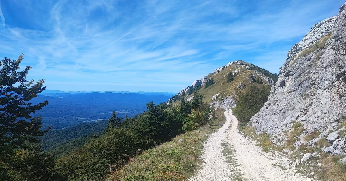
Everyone who drives through Korenica is on their way to Plitvice Lakes. Almost nobody looks up. If they did, they would see a bare, rocky summit rising 3,300 feet1,000 meters above town, crowned by the ruins of a Yugoslav radar station that once watched the skies over half of Europe. That summit is Gola Plješivica, and hiking to it from Korenica turned out to be one of the highlights of the trip my wife and I made through Croatia in late 2025.
A group of Croatian hikers we met at the top, who climb it every year, called it the best hiking trail in Croatia. I have not hiked enough of Croatia to crown it myself, but I understand why they said it. You get deep forest, a proper leg-burning climb, views into two countries, and a summit that doubles as an open-air Cold War museum. Here is everything you need to plan it yourself, plus what we learned the hard way.
Trail facts at a glance
| Hiked | Late 2025, on an unseasonably hot day |
| Trailhead | Korenica town centre, at the hiking map signpost next to the town’s only Chinese restaurant |
| Summit | Gola Plješivica, 5,400 ft,1,646 m, on the border of Croatia and Bosnia and Herzegovina |
| Distance | Roughly 12.5 miles20 km round trip from town |
| Elevation gain | Around 3,600 ft1,100 m |
| Time | The sign in town says 4 hours to the top, which matched our climb. The descent is faster. Count on 7 to 8+ hours round trip with breaks. |
| Waymarks | Croatian red and white circles, frequent and reliable |
| Water | None on the trail. Carry 2 to 3 quarts2 to 3 liters per person on warm days. |
| Difficulty | Hard, mostly for the length and the sustained climb. No scrambling. |
Distance and elevation are rounded route figures, not a GPS recording of our day. Times are our own.
Safety First: Read This Before You Go
This is not a trail where you wander off to find a better viewpoint.
Before you go
- Mines. Leftover mines from the wars of the 1990s are a documented hazard in this area. Stay on the waymarked trail and, higher up, on the road.
- No water, little shade. The fields and the power-line climb are fully exposed. Start early.
- Tunnels. Do not enter the summit tunnels without a proper light source.
- Turn back if you are low on water before the treeline, storm clouds build over the ridge, or you started late in the short-daylight months. The mountain will still be there tomorrow.
- Emergency: call 112. Mountain rescue in Croatia is the Croatian Mountain Rescue Service (HGSS).
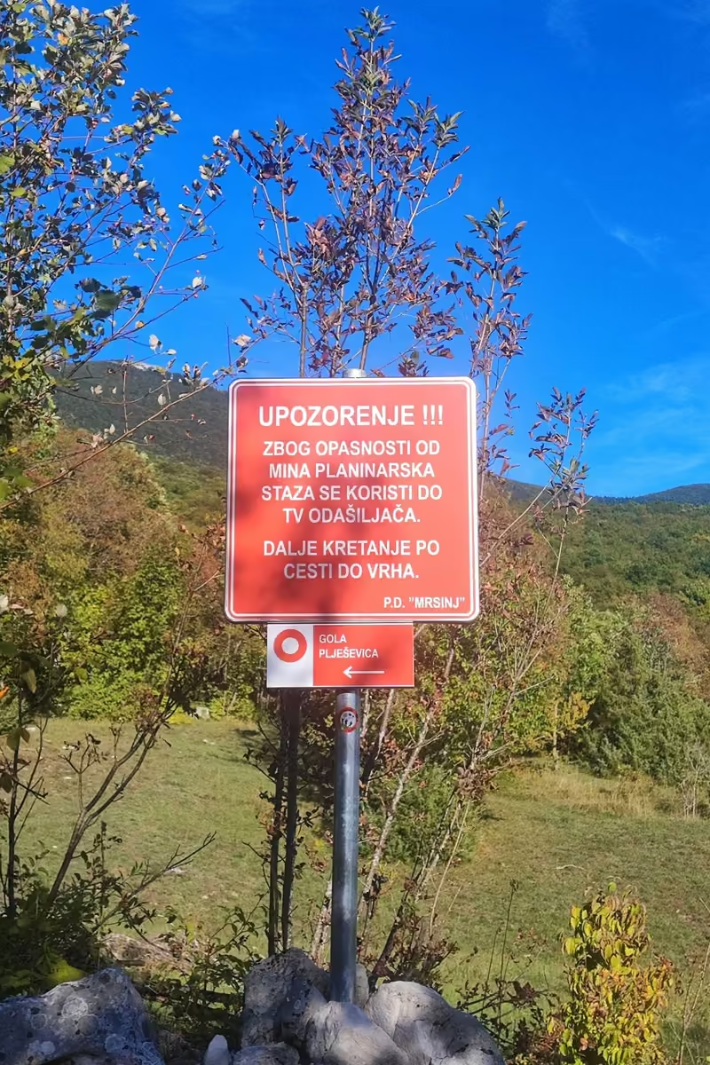
Mines. Where the route leaves the road and heads into the forest, a red warning sign from the local hiking club, PD Mrsinj, stands next to the trail marker. In my translation it reads: “Warning! Because of the danger of mines, the hiking trail is used as far as the TV transmitter. From there, continue along the road to the summit.” This is not a theoretical warning in the Plješivica area; the wider region around the old air base saw fatal mine accidents after the war. The marked trail itself is in regular use. Stay on it, keep to the road where the sign tells you to, and resist the urge to explore unbeaten side tracks around the ruins. We kept that sign in the back of our heads all day, and you should too.
No shade, no water on long stretches. The first section crosses open fields and the final push climbs an exposed slope under high-voltage power lines. On a hot day this is serious. Start early.
The tunnels. There are dark tunnels in the summit complex. Do not enter them without a proper light source. We did not bring flashlights, so we stayed out, and I would suggest the same unless you come prepared.
Exposed ridge weather. The summit is bare (gola literally means “naked”) and the wind up there was strong enough to give our drone a genuinely hard time. Skip the hike if thunderstorms are forecast.
Border area. The summit sits right on the border between Croatia and Bosnia and Herzegovina. Carry ID, stick to the marked route, and do not treat the ridge as a border crossing.
Where to Stay: Korenica Makes This Easy
We had booked an Airbnb in Korenica, a small town on the main D1 road about 20 minutes south of the Plitvice Lakes entrances. Most people treat it purely as a cheaper base for the lakes. It turned out to be a five-minute walk from our door to the trailhead, which meant no driving, no parking stress, and an early start with zero friction.
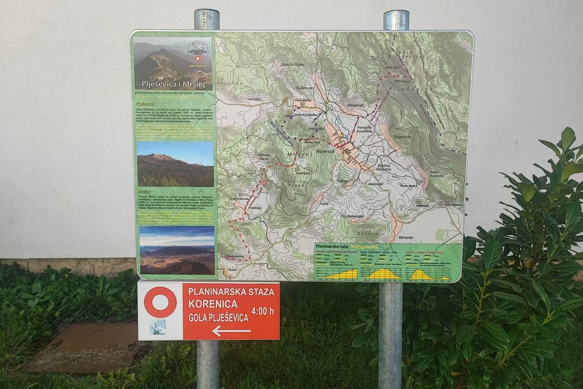
The trail officially starts at the hiking signpost in the centre of town, right next to the local Chinese restaurant. Below the map you will find the first red and white waymark. From there, the circles guide you the entire way; we found them clear and reliable even in the most overgrown sections higher up. Local signs spell the mountain Plješevica; you will see both spellings.
Trail tips, news and giveaways
One email a month: hiking tips, gear news, giveaways, fresh footwear verdicts and more. No spam, unsubscribe anytime.
The Trail, Section by Section
Korenica to the Forest Edge (About 30 to 40 Minutes)
The first stretch follows quiet roads and tracks through open fields just outside town. It is flat, fully exposed, and honestly more of a warm-up than a hike; we saw exactly one car. We hiked on an unseasonably hot day, so I was glad we left early, before the sun had any real power. The upside of this section: Gola Plješivica’s summit is visible ahead of you almost the whole time, which builds the anticipation nicely.
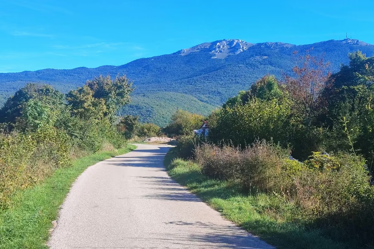
After a good half hour you reach a farm, and the route passes through private property. This is where the road ends and the real trail begins.
Local tip: the Croatian hikers we met had parked their car right here, where the road turns to trail. If you have a car, consider doing the same. We enjoyed the field section on the way out, with the mountain ahead of us. On the way back, you are staring at empty fields with the town in the distance, and it drags. Skipping it saves you around an hour of the least interesting walking of the day.
The Forest Climb (About 1.5 Hours)
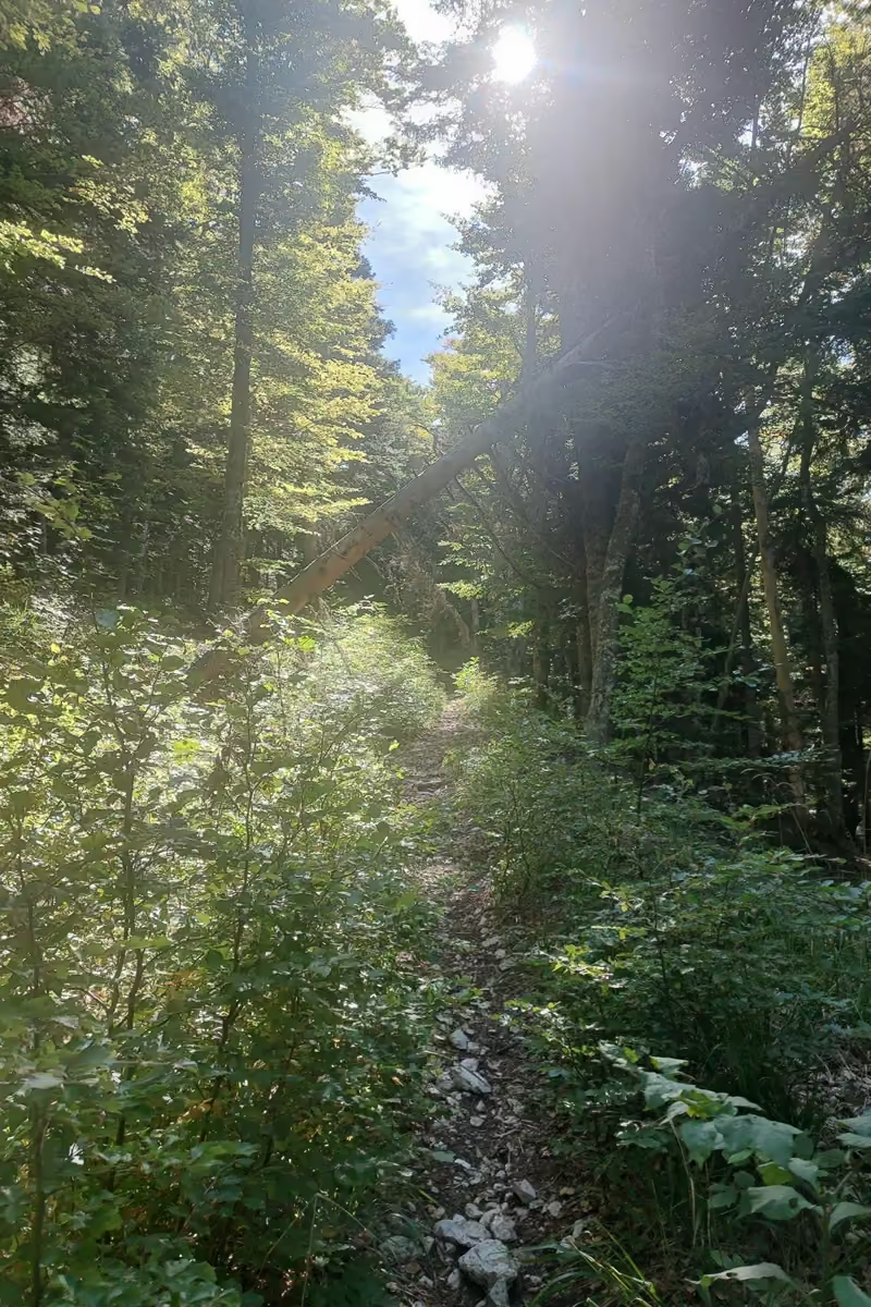
Right where the trail enters the forest stands the mine warning sign I mentioned above. Take it seriously, then enjoy what follows, because this is lovely hiking: shaded woodland with a steady gradient, broken up every so often by open patches with fresh views of the summit.
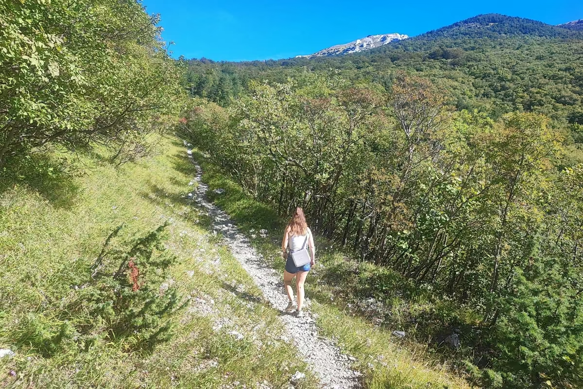
Higher up, the forest thickens and the path spills onto a much wider track with clear signs of logging activity. By this point the day was heating up properly and we were grateful for the tree cover. Keep an eye on the waymarks here: after a while the trail takes a right turn off the wide logging track and starts climbing more seriously again.
The Steep Upper Section (About 1 to 1.5 Hours)
Eventually you cross an old road, and the gap in the trees shows you exactly how close the summit already is. It is tempting to head straight up from here, but the direct line is very steep, and more importantly, the waymarks send you a different way. Follow them.
The next stretch is the one part of the route where we briefly doubted ourselves. The trail gets overgrown with bushes, and more than once it felt like we had wandered off course. We had not; the red and white circles kept appearing exactly when we needed them. Trust the paint, not your gut.
Then comes the toughest part of the day: a steep, sun-blasted climb alongside high-voltage power lines. There is no shade and no way around it, just a slow grind upward. This is where you will be glad you carried extra water. Near the top, an old building offers the first shade in a long while; we used it. From there, a sharp left turn puts you on the final approach to the summit.
The Summit Ridge and the Fortress (Final 20 to 30 Minutes)
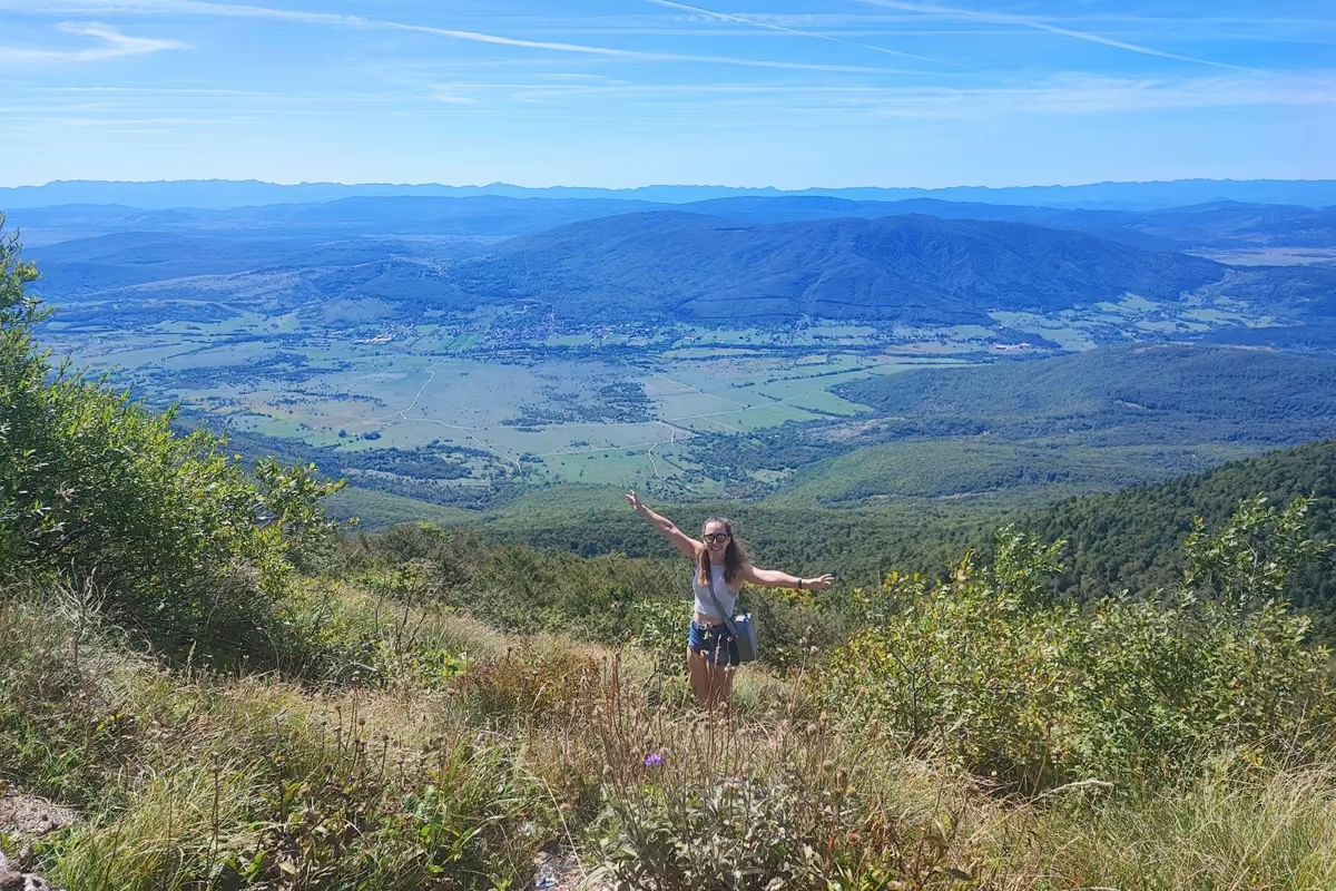
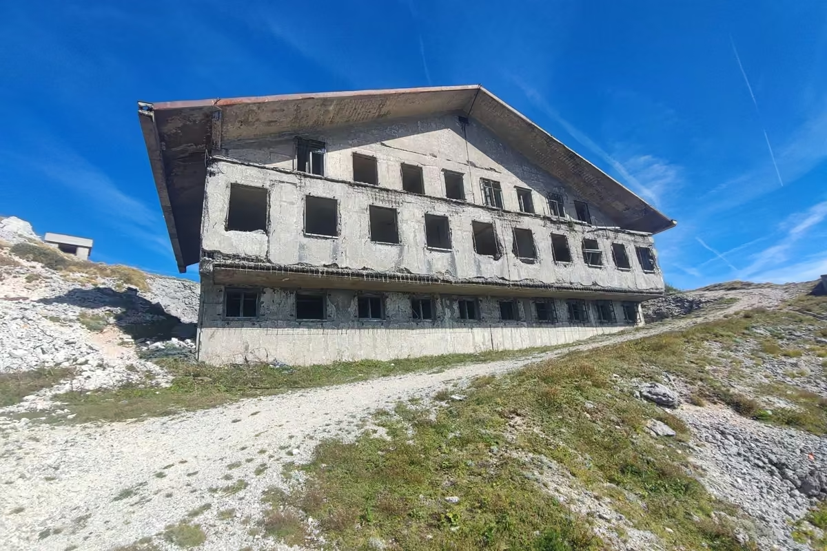
Closing in on the top, two things happen at once: Bosnia and Herzegovina opens up on your right, and the first tunnel entrances appear in the rock. What locals casually call the fortress is actually the wreckage of a major Yugoslav military radar station. Before the wars of the 1990s tore the region apart, the radar up here monitored airspace hundreds of mileshundreds of kilometers in every direction, and the mountain below your feet hides Željava Air Base, once Yugoslavia’s largest underground airfield, with mileskilometers of aircraft tunnels carved into the massif. Walking through the shattered concrete at 5,400 feet,1,646 meters, with the wind howling through empty window frames, is a strange and memorable way to finish a climb.
At the Top
We spent a long time up there, and I would plan for that rather than tagging the summit and turning around. The panorama runs from the Lika plateau on the Croatian side to the hills of Bosnia and Herzegovina stretching east. We had lunch in the lee of a wall, explored the ruins along the obviously well-trodden paths (with that mine sign still in mind, we did not push into anything unbeaten), and cooled down in the wind after the hot climb.
We also flew our drone from the summit. The footage is spectacular, but be warned: the wind up there worked the motors hard, and I would not launch anything in stronger conditions. If you fly, check current Croatian and EU drone regulations first; this is a border ridge next to a former military installation, so do not assume it is a free-for-all.
The Croatian hikers we shared the summit with told us they make this climb every single year. When locals keep coming back to the same mountain, that tells you more than any review score.
The Way Down
The descent is straightforward and faster than the climb; we were well under the sign’s 4 hours. We ended up walking a stretch with the Croatian hikers, chatting about trails, which is its own argument for this route: it is popular enough that you will likely meet people, quiet enough that every meeting feels like company rather than a crowd.
As mentioned, the final field section back into Korenica is the anticlimax of the day. If you parked at the forest edge, you will be sipping a drink in town while walkers like us are still trudging past the fields.
When to Go and What to Bring
Season: late spring through autumn is the sensible window. We hiked it late in the year and still got a hot day, but daylight gets short then, so start early. In winter, snow and the exposed ridge put this in a different category entirely.
Bring:
- 2 to 3 quarts2 to 3 liters of water per person; there is none on the trail
- Sun protection: hat, sunscreen, sunglasses (the field section and the power-line climb are brutal in full sun)
- Sturdy hiking shoes; the upper trail is rocky and overgrown in places. If your ankles need backup on terrain like this, our hiking boot recommendations for ankle support apply here word for word.
- Lunch for the summit; it is the obvious long break and you will want the time up there
- A headlamp or flashlight if you want to peek into the tunnels (we regretted not having one)
- Layers: the summit wind is real, even on a hot day
- Passport or ID card, since the summit sits on the border
Not sure whether you need a boot at all for a trail like this? Our guide to whether you need ankle support for hiking goes through that choice, and our La Sportiva TX4 Evo review shows what an approach shoe does on rocky ground like this.
Common Mistakes to Avoid
- Leaving the marked trail. Worth repeating one last time: mines from the 1990s wars are a documented hazard here. The trail is safe and well marked; the terrain beside it is not your playground.
- Starting late on a warm day. The two most exposed sections (the fields and the power-line climb) are misery in midday sun. Leave town at or before sunrise in summer.
- Underestimating water. No springs, no huts, no shops after Korenica. We took our time on a hot day and needed everything we carried.
- Assuming you are lost in the overgrown section. The bushes close in and the path fades, but the waymarks keep coming. Look for the next red and white circle before backtracking.
- Doing the full road section both ways with a car available. Park at the forest edge and spend that saved hour at the summit instead.
After the Hike: Eat at Restoran Šapina
One more piece of hard-earned advice. That evening we had dinner at Restoran Šapina in Korenica, and it was good enough that we went back the next day. After eight hours on a mountain, a plate of hearty Lika cooking is exactly what you want, and this place delivers. Between the trailhead, the Airbnb and Šapina, Korenica quietly turned into one of our favourite stops in Croatia.
Is This Hike for You?
If you are visiting Plitvice Lakes and want one real mountain day away from the boardwalk crowds, this is the one I would pick. You need decent fitness for the 12.5 miles20 km and 3,600 feet1,100 meters of climbing, the discipline to stay on the trail, and an early alarm. In return you get forest, silence, a summit with views into two countries, and a chunk of Cold War history most travellers never hear about, all starting from a town you can walk out of after breakfast.
The Croatians called it the best trail in their country. I will just say this: of everything we did on our trip through Croatia, this is the day we still talk about most.
FAQ
Is the Gola Plješivica Trail Safe Given the Mine Warnings?
The marked trail is in regular use by local hikers and was clearly waymarked when we hiked it. The danger is in leaving it: unexploded ordnance from the 1990s wars remains a documented hazard in the wider Plješivica area. Follow the sign at the forest edge, which says the hiking trail is used as far as the TV transmitter and that you continue on the road from there, and stick to well-trodden ground at the summit.
Can You Visit Željava Air Base on This Hike?
Not really. The famous aircraft tunnels sit at the foot of the mountain, reached by road, and are a separate visit. What you see on this hike is the ruined radar complex on the summit, which is impressive in its own right.
How Long Does the Gola Plješivica Hike Take?
The sign in Korenica says 4 hours to the summit, which matched our climb at an easy pace on a hot day. The descent is faster. Plan 7 to 8+ hours door to door, including a proper summit break.
Do I Need a Car?
No, and that is part of the charm: the trail starts in Korenica itself. A car does let you skip the least interesting 30 to 40 minutes of field walking by parking where the road becomes trail at the forest edge.