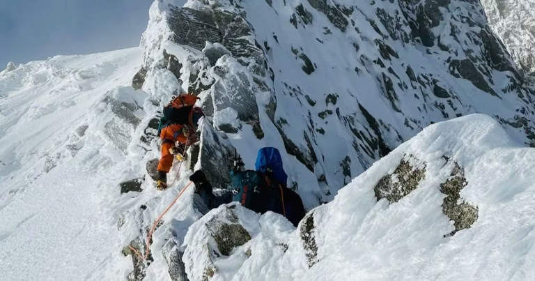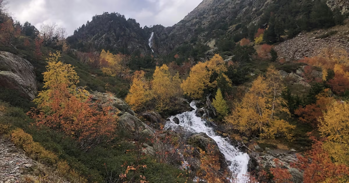
Standing at 9,652 ft,2,942 m, Coma Pedrosa is Andorra’s highest mountain. It is a steep and challenging climb, but the quiet trails and the dramatic views over alpine lakes and mountain peaks are well worth the effort.
I climbed it from the village of Arinsal on 20 October 2026, late in the season, with autumn colour in the valleys and cloud swirling around the summit. Here is how to get there, what to expect on the trail, and how my day actually went, including the bus that left without me.
Trail facts at a glance
| Hiked | 20 October 2026 |
| Start and finish | Aparcament d’Arinsal (last stop of the L5 bus), Arinsal, Andorra |
| Summit | Coma Pedrosa, 9,652 ft2,942 m, the highest point in Andorra |
| Distance | About 9.6 miles15.4 km out and back |
| Elevation gain | About 4,500 ft1,370 m |
| My time | 6 hours up and back, with plenty of photo stops (official estimate: about 8 hours) |
| Waymarks | Red and white stripes, then yellow dots from the turn-off above the refuge. Easy to follow until the final scree slope. |
| Water | Streams along the trail. The refuge is staffed 1 June to 12 October only. |
| Difficulty | Challenging: steep, sustained climbing and a short scramble up scree near the top |
Distance and elevation are rounded route figures, not a GPS recording of the day. Times are Victoria’s own.
How to Get to Arinsal
The Coma Pedrosa hike begins in Arinsal, a mountain village about 7 miles11 km north of Andorra la Vella and a 20-minute drive away. You can park at Parking Pal Arinsal. Alternatively, take the L5 bus from Andorra la Vella central bus station to the last stop, Aparcament d’Arinsal.
The buses are scheduled every 20 to 30 minutes from 6:50 am until 10:20 pm, though I found they didn’t stick to this timetable and simply left when they were ready. Buy your ticket at the bus station, as only cash is accepted on board, and leave plenty of time. I started my hike an hour later than planned because of buses that didn’t show up. My return ticket cost €5.70.
The closest international airport is Barcelona El Prat, about three hours’ drive away. Andorra Direct Bus runs coaches between the airport, Barcelona Sants and Andorra la Vella bus station. A single ticket was €35 when we checked in November 2026.
When to Go
The hiking season in the Comapedrosa Natural Park runs from late May to October. In spring and autumn it is essential to check the weather, recent snowfall and the summit webcam before you set off. Snow can stay on the peak well into June, which makes the climb impossible without crampons and winter gear.
I climbed Coma Pedrosa on 20 October, and the autumn foliage and wispy clouds gave the whole day a magical feel. Afternoon storms are common in the mountains here, so start early and aim to be back down by 5 pm.
Trail tips, news and giveaways
One email a month: hiking tips, gear news, giveaways, fresh footwear verdicts and more. No spam, unsubscribe anytime.
How Difficult Is It?
The climb from Arinsal to the mountain refuge is a moderate, sustained ascent. From the refuge to the summit it is challenging. The last section is a scramble up a steep scree slope where the waymarks are hard to spot. Below that, the trail is generally easy to follow and well signposted.
How Long Does It Take?
It is about 9.6 miles15.4 km from Arinsal to the summit of Coma Pedrosa and back, with about 4,500 ft1,370 m of elevation gain. It took me six hours, including plenty of stops to take photos and rest. The official Andorra hiking information puts the route at around eight hours, so leave yourself plenty of time.
Water, Food and the Refuge
The Refugi de Comapedrosa, at 7,415 ft,2,260 m, is the only place on the route with facilities: toilets, drinking water and a restaurant. It is staffed from 1 June to 12 October, though. Outside those dates it opens by reservation only, so don’t count on food or water there late in the season. I hiked after it had closed for the season and didn’t stop, but I met a few people coming down from it who must have booked ahead.
The trail crosses several fast-flowing high-altitude streams where you can refill your bottle. Bring a filter or purification tablets, and carry enough snacks for the whole day.
Footwear: What I Wore and What I’d Wear Next Time
I hiked the route in the women’s Scarpa Rapid GTX, a lightweight, waterproof approach and hiking shoe. As the trail has steep sections on rocky slabs, these were an excellent fit. They have a Vibram Megagrip sole, which made me feel secure and confident scrambling quickly and moving over scree and loose rock.
If I hiked the trail again, especially in colder conditions, I would choose an approach boot for more ankle support on the uneven ground. The La Sportiva TX5 Evo Mid GTX would be perfect.
The terrain is moderate enough that you will be fine in any comfortable hiking shoe, but a high-friction rubber sole is a definite advantage. I recommend approach shoes with good grip on rock over trail runners. (Our guide to the best approach shoes compares the options, and if you are deciding between a low shoe and a mid boot, see whether you need ankle support for hiking. Ed.)
My Day on Coma Pedrosa
Getting to the Trail
My plan was to take the first L5 bus from Andorra la Vella at 6:50 am and start hiking at 7:15 am. Advice online encourages hikers to start in the dark to avoid afternoon storms.
This did not go to plan. The bus had left early, and I waited another 30 minutes for the next one. The staff in the bus station told me I could buy my ticket on the bus, but it turned out you can only pay cash on board. I went back to the station, bought a ticket, and eventually got on a bus at 7:40 am. I stayed on the L5 until the last stop, Aparcament d’Arinsal. The journey took 25 minutes.
To get onto the trail from the car park, turn left and walk through the tunnel. Turn left again and you will see the welcome sign for the Comapedrosa Natural Park. From here the trail is well marked: follow the red and white stripes on trees, rocks and signposts.
From Arinsal to the Mountain Refuge
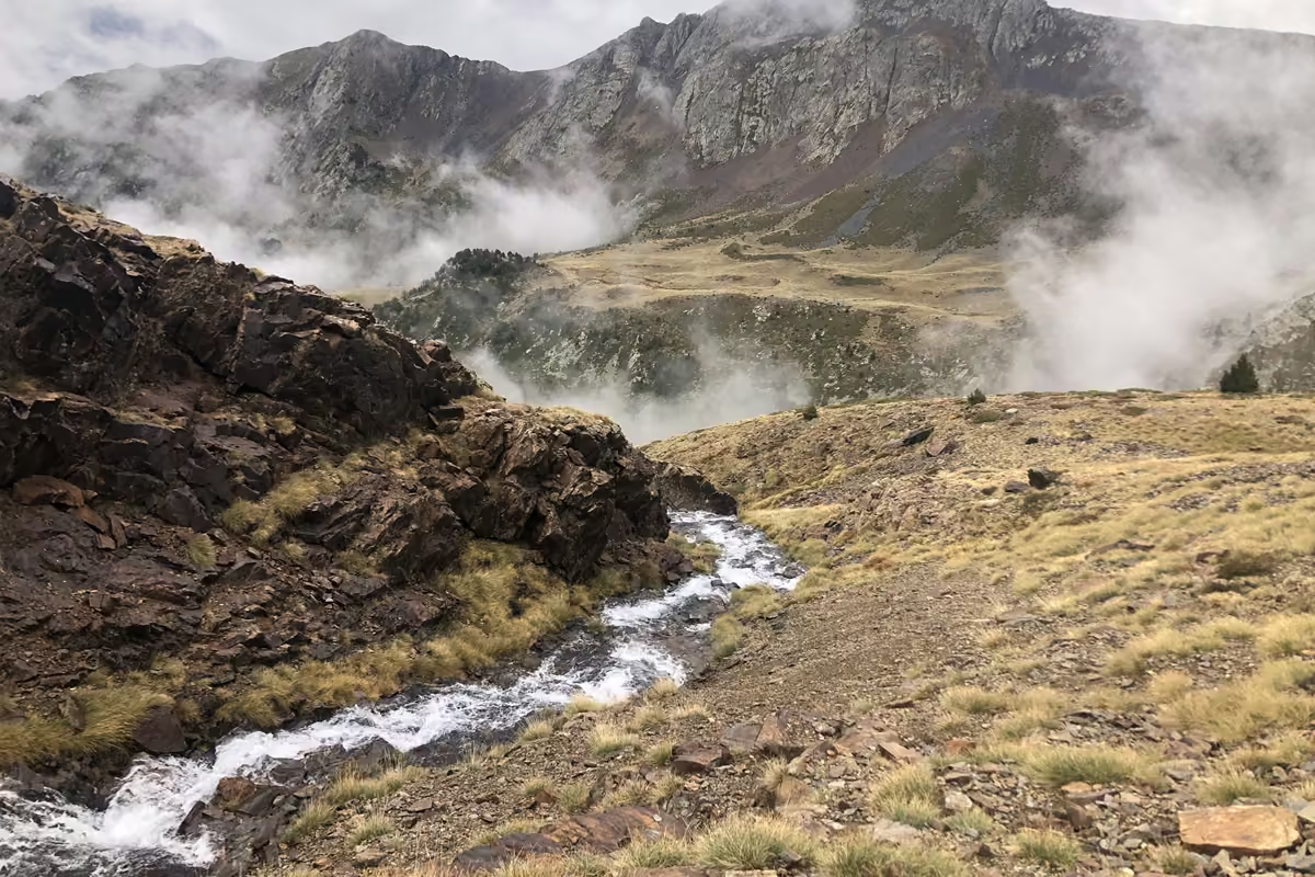
The hike begins by winding through the forest on a gentle incline. It crosses the river three times, and the white water and occasional waterfall are incredibly picturesque. After around an hour I broke out of the trees and got a gorgeous panorama of the surrounding mountains, with my first glimpse of Coma Pedrosa in the distance. The colourful October leaves brought the landscape to life, and the wispy clouds swirling past gave it a dramatic, mystical feel.
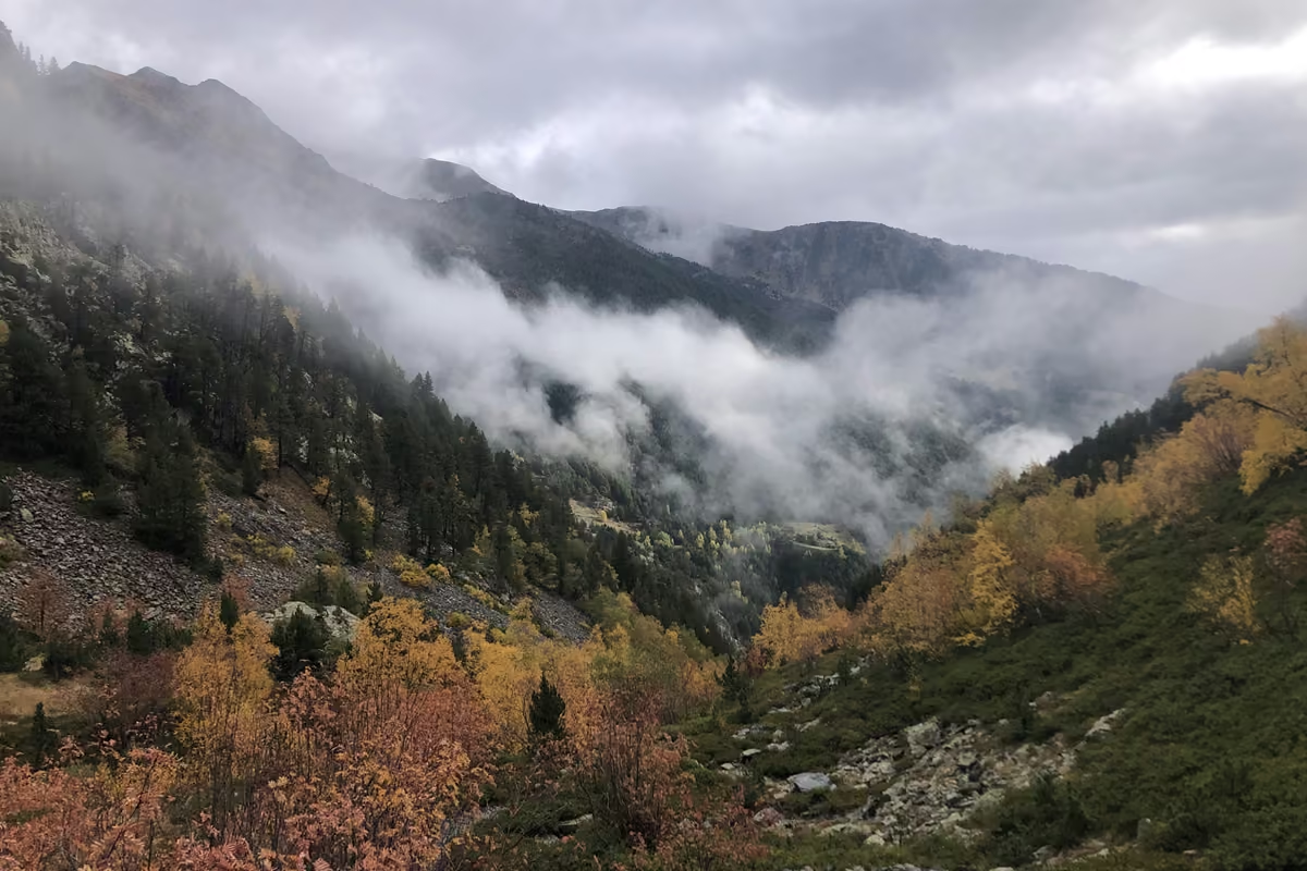
After the forest, the trail gets much steeper. It hugs the river closely, and I had to stop every few minutes to catch my breath and take photos of the waterfall ahead. At the top of the waterfall I finally found another signpost and realised I was just round the corner from the refuge. I balanced on logs across the river and then enjoyed gentler terrain for the next 1.2 miles.2 km.
The refuge is easy to spot from the trail, and it is a 10-minute detour to reach it. I had plenty of snacks and water and wanted to be quick after my late start, so I didn’t go. In season it is a beautiful spot for a break.
From the Refuge to the Summit
After the flat section weaving through the valley, I reached another waymark pointing right, steeply up the mountain. From here, follow the yellow waymarks instead of the red and white ones. The trail switchbacks up to the Estany Negre (the Black Lake), a stunning deep blue alpine lake set against jutting peaks. Tiptoe around its shore before climbing steeply to the next signpost.
From here the summit of Coma Pedrosa looks close, but it is so steep it is hard to imagine a way up. I took a five-minute detour to the Portella de Baiau viewpoint, and it was so worth it. The view of three azure alpine lakes set in a ring of mountain peaks was the highlight of the entire hike.
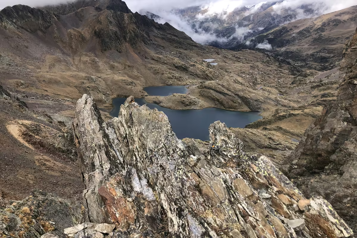
I stayed a while taking photos and enjoying the view, as I knew the summit itself would be in cloud. It was significantly colder up here than in Arinsal, and I wished I had brought thicker gloves. Thankfully I soon warmed up on the push to the top.
Walk back from the viewpoint to the signpost and follow the yellow waymarks onto the scree slope. This is the most difficult part of the hike. The ground is loose and uneven, and I kept losing the waymarks. Keep angling upwards and you should come across another one soon. Even a little ice or snow would make this section impassable without proper gear, so check the webcam and the forecast closely, especially in spring and autumn.
After three and a half hours of hiking, I was relieved to reach the summit. It was clouded over, so I couldn’t see much, but the bright summit marker felt celebratory. I enjoyed looking at the stickers other hikers had left and reading the messages scribbled on rocks.
The Descent
After a few minutes on the summit, it was time to warm up and head down. I moved much faster on the descent. I took a different line from the way up, with more scrambling but on solid rock rather than scree. The two paths meet again at the Estany Negre, and from there the way down was easier and quick.
The sky was turning greyer and I kept moving, keen to avoid the afternoon storms I had been warned about. After two more hours of hiking I was back in Arinsal, exhausted but satisfied after a great adventure.
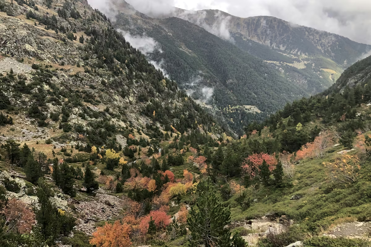
My favourite things about this trail were the autumn foliage and how quiet it was. I saw almost nobody else on the trail, and it felt truly secluded despite being so close to busy Andorra la Vella.
The bus journey back was far smoother. It picked me up where I had got off, and I rode back to Andorra la Vella for a coffee and a sweet treat at the Santagloria bakery.